

Weekly Weather Headlines: Cooler and drier out west before the arrival of another potential system with wintry precipitation and more severe weather possible across the Southern Plains and Southeast

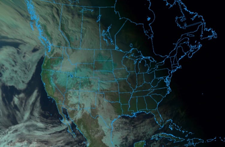
Live satellite imagery as a low pressure system situated over the four corners continues to track east with the sunset on January 23, 2023 seen from the College of DuPage’s online meteorological satellite web browser
Duck, duck, and goose as yet another storm system is on par to bring severe weather across portions of Southeast through Tuesday evening into Wednesday morning on top of the potential of very gusty winds expected with the gulf inflow and behind the front prompting a red flag warning on the drier side of the front into the Rio Grande Valley. On the northern end of the front it’ll be gradually cooler with the potential for light wintry precipitation accumulations potentially within the Dallas metropolitan area with heavier wintry precipitation to the north and west of town. Multiple winter weather advisories and winter storm warnings have been issued ahead of the system spanning from the southwest all the way to the great lakes. Some model guidance has even been picking up on the potential of yet another cooler system if not two or three heading into February though once again, confidence is still very sparse given the potential time frame being well over a week to two out. In the meantime however, on the severe side of the system which includes the cities of Houston New Orleans, Mobile and Tallahassee, strong storms are expected with an enhanced risk in place for much of this area on Tuesday into Tuesday evening due to the potential of damaging winds and widespread supercell activity, all capable of producing strong updraft with a few strong tornadoes not out of the question (especially in and around the coastal plains region south, west and east of Houston). A marginal risk of severe weather will span across much of the Southern Atlantic states as the system pushes east Tuesday night into Wednesday. Thankfully, instability should weaken significantly heading into that time period making the threat not nearly as sporadic as so on Tuesday though, any chance is a chance and should never be fooled around with
With the exception of a bomb cyclone during Christmas, it has been a relatively quiet snow year with warmer than usual temperatures for the season across much of the Northeast and Mid Atlantic though, how long will it last you may be asking? And the answer to your question is later this week with a system moving east that is expected to bring snowy conditions throughout much of the Northeast with cooler and rainy conditions on the southern end of the system into the Mid Atlantic. Another system behind this one may also result in snowier conditions once again though, winter conditions may remain further inland with that system as conditions near the coastline (with the exception of Maine), may be too warm for snow. With constant daily data change however, it’s still not out of the woods just yet that in future forecasts areas closer to the coasts may be included for the potential of seeing winter weather.
It has been a wet December into January out west where many of the same areas kept getting evacuated over and over again due to the potential imminent threat of flooding or landslides especially, in and around burn scar locations. A minor system may be in play heading into the later half of this weekend into early next week though thankfully, it shouldn’t be anything too major with widespread amounts likely to be below or near an inch with localized amounts above an inch possible. In the meantime, drier and cooler conditions will prevail through the remainder of this week with offshore gusts (some strong) possible through the end of this week. While such conditions typically lead to fire concerns thankfully, given recent precipitation and mountain high snow, elevated conditions should remain sparse if at all given poor fuel reception.